Hi River Roaders,
This week we’ll take a deep dive into the rocks that are underneath our grounds. This blog was developed by Andrea Mangum, who also collaborated on the “Springs!” blog last year. It’s a great example of the “detective” work that is practiced by geologists.

RRUUC (and virtually all of Montgomery County) is located in the Piedmont province. Our regional climate promotes development of thick soils which cloak the weathered “hard rock” formations of the Piedmont. Our local geology is not on display as in the arid western U.S. Subsequently, geologists have used outcrops along stream valleys, road cuts, building sites, etc. to map the underlying rock formations and better understand Earth history. Unfortunately, the RRUUC property doesn’t have rock outcrops, which means detective work is needed to understand the underlying geology. Most of the rocks at the front of the property have clearly been transported to the site for landscaping purposes, but the rocks we find out back are likely native to our site.
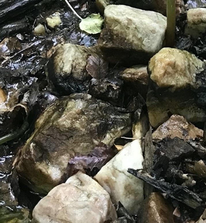
Quartz and more quartz! Hunks of quartz of all sizes are everywhere on the RRUUC grounds. They range from white to gray to brownish in color. Most of it is concentrated in the down-cut channels of the spring-fed streams. Resistant quartz (<20% of original mineral assemblage) remains after the softer minerals in the original bedrock break down, with the topic of soil being worthy of its own blog.
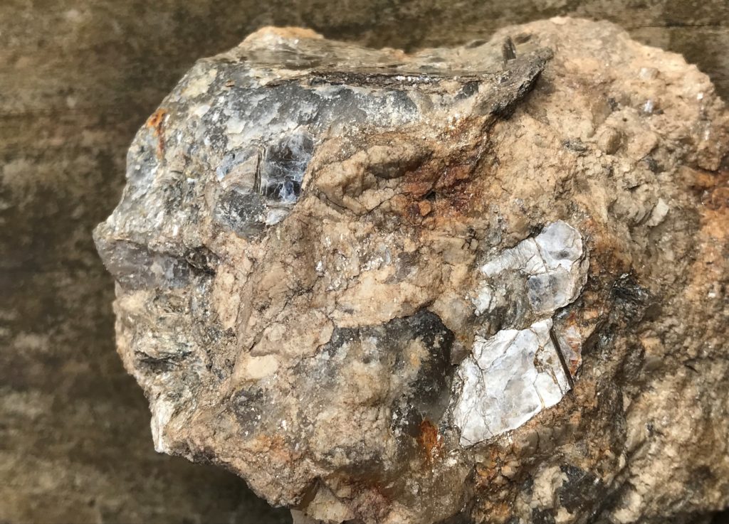
Some mostly-quartz rocks still have traces of softer minerals (like the mica above). The missing 80% of the original rock was composed of mineral groups including amphiboles, pyroxenes, feldspars, and micas. This small rock is typically located on top of the larger quartz boulder in the worship circle in the back. Take a look!
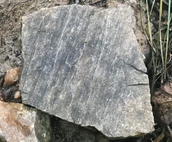
Several of the rocks in the back feature striations that feel and look like “slickensides” which are recrystallization features caused by the friction between rocks along a fault fracture. The grooves parallel movement on a fault plane. When found in place on an outcrop, slickensides allow field geologists to interpret fault motion.
The lack of onsite outcrops led us to examine geology maps, all made before the area was as suburban as today. The Maryland Geological Survey (MGS) last updated local geology maps in 1968 (below) that are available under Maryland Geology at http://www.mgs.md.gov/esic/geo/mon11.html.


The roads are not precise so it is a bit tricky to zero in on one’s exact location. The 1968 map suggests that the RRUUC property is in the Georgetown Mafic Complex (Gm), which is Early Paleozoic to Late Precambrian in age OR the Kensington Quartz Diorite (Pzk) formation, which is Paleozoic in age. Rocks formed in the Paleozoic are between 250 and 500 million! years old.


The 1953 map above reveals that the Kensington Quartz Diorite lies beneath the RRUUC property which meshes with the abundance of quartz we observe. Although the geologic age estimates and descriptions of the formations in 1953 are less sophisticated than those recorded on the 1968 map, the mapping of the formation boundaries in this area have changed little to none
That said, natural springs are known to sometimes emerge at geologic contacts. Thus, the natural springs behind RRUUC may indicate that the Georgetown Mafic Complex reaches the north edge of the property where it abuts the Kensington Quartz Diorite.
Additional hand samples with possible slickensides on the property may be related to a formation contact. However, we have not found rocks clearly derived from the Georgetown Mafic Complex on the property. Our outstanding question remains: Is this lack of evidence due the heavy weathering of the bedrock OR because the contact is not on the property?
This blog combines the geology homework of Andrea Mangum with the field geology experience of Dr. Craig Schiffries and site history knowledge of Joe Saliunas.